
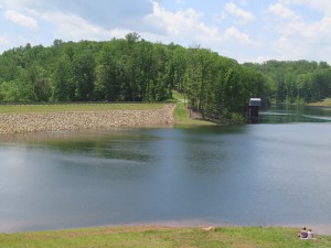
Reservoirs
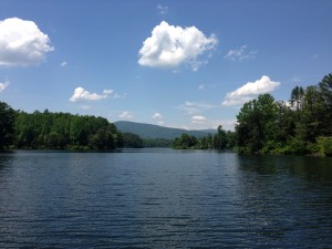
- Ragged Mountain Reservoir
- Sugar Hollow Reservoir
- South Rivanna Reservoir
- Beaver Creek Reservoir
- Totier Creek Reservoir
Dam Reaches Full Capacity
Storage Capacity: 1.4 billion gallons of stored water when 100% full
Water Surface Area: 170 acres
Watershed: 2 square miles
Area Served: Urban Water System
Fact Sheet: Ragged Mountain Reservoir
For more information about the Ragged Mountain Dam, please visit: https://www.rivanna.org/ragged-mountain-dam/
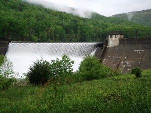
Sugar Hollow Reservoir in Spring
Storage Capacity: 339 million gallons of stored water when 100% full
Water Surface Area: 47 acres
Watershed: 18 square miles
Area Served: Urban Water System
Fact Sheet: Sugar Hollow Reservoir
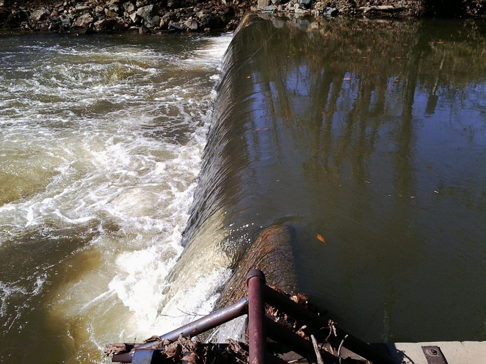
The current Sugar Hollow Dam was built in 1947 to supply water for the community. The low head dam visible at the toe of the spillway was built in 1920 to primarily supply water to Ragged Mountain Reservoir and the City of Charlottesville. It is connected to the Ragged Mountain Reservoir via a 13-mile pipeline. Water spilling over the dam flows into the Moormans River which is a tributary to the South Fork Rivanna River. These three interconnected reservoirs act as one system to adequately provide the drinking water for our urban area now and in the future. The Sugar Hollow reservoir is the highest elevation of the RWSA’s three dams used for our urban water supply, and, as such, has been used to help fill the others. In 1995, a record setting flood occurred. In 1998, the dam was upgraded for dam safety. Subsequently, the Sugar Hollow dam rehabilitation project won the National Dam Rehabilitation of the Year project in 2000 from the American Society of Dam Safety Officials (ASDSO).
For more information, read the Sugar Hollow Dam Fact Sheet.
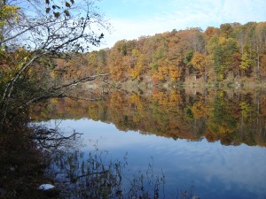
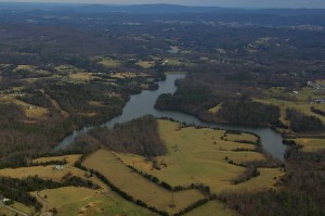
South Rivanna Reservoir in the Fall
Storage Capacity: 885 million gallons of stored water when 100% full
Water Surface Area: 366 acres
Watershed: 259 square miles
Area Served: Urban Water System
Fact Sheet: South Fork Rivanna Reservoir
The South Fork Rivanna Reservoir, located off Route 29 north of Charlottesville on the South Rivanna River, was constructed and began storing water in 1966. The reservoir was constructed to be the largest raw water source for the urban community area. The reservoir has a drainage area of 259.1 square miles and a surface area of 366 acres and a useable volume measured in 2002 of 800 million gallons. Two major streams, the Mechums River and Moormans River are tributaries to this reservoir. The dam height is 60 feet with the normal pool level at 382 feet. Surface area of the permanent water pool is 366 acres. The dam was retrofitted to include a 958 kilowatt hydropower plant in 1983. This hydropower plant is currently not operable, but an evaluation resulted in a board decision to decommission the plant for economic and operational reasons. This reservoir is the raw water source for the South Rivanna Water Treatment Plant.
This reservoir is very popular both for canoeing and kayaking and is also known for its excellent fishing. Both swimming and gasoline motor boating are prohibited since this reservoir is a community raw water supply.
We are proud to partner with the men’s and women’s UVA Championship Rowing team and the Rivanna Rowing Club. Since 1989, we have worked closely with the team to allow the necessary access to the South Fork Rivanna Reservoir and continually coordinate on ways to minimize impacts from the use of their gas-powered motor boats. “The UVA women’s and men’s rowing team plus the Rivanna Rowing Club appreciate RWSA’s willingness to allow this permit. [It] is an essential component to achieving success.” –Kevin Sauer, Head Coach
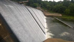
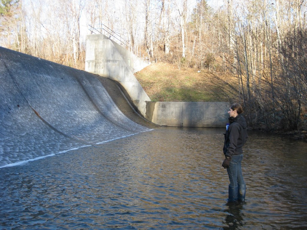
South Rivanna Spillway
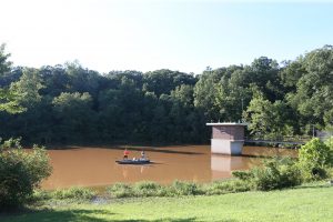
Beaver Creek from the shore
Storage Capacity: 521 million gallons of stored water when 100% full
Water Surface Area: 104 acres
Watershed: 10 square miles
Area Served: Crozet
Fact Sheet: Beaver Creek Reservoir
Beaver Creek Dam was originally designed and constructed in 1963 by the United States Department of Agriculture, Natural Resources Conservation Service, which was formerly known as the Soil Conservation Service. The dam and reservoir were designed to have sediment storage, water supply storage, and flood control storage components. Currently Beaver Creek Reservoir supplies water to the Crozet area and at construction had a design volume of 521 million gallons for useable water supply storage. Drainage area for this reservoir is 9.55 square miles.
Beaver Creek Reservoir
This reservoir is popular for canoeing, kayaking, and fishing. Beaver Creek is home to the Western Albemarle High School Warriors rowing team. One of Albemarle County’s public parks, Beaver Creek Reservoir is stocked with sunfish, channel catfish, and largemouth bass. Both swimming and motor boating is prohibited since this reservoir is a community raw water supply.
Totier Park located near Scottsville in Albemarle County, Va. Photo/Andrew Shurtleff
Storage Capacity: 155 million gallons of stored water when 100% full
Water Surface Area: 66 acres
Watershed: 29 square miles
Area Served: Scottsville
Fact Sheet: Totier Creek Reservoir
Totier Creek Dam was originally designed in 1969 and construction was completed in 1971. The dam and reservoir were designed to have sediment, water supply, and flood control storage components. Currently both Totier Creek and Totier Creek Reservoir supplies water to the Scottsville area and at construction had a design volume of 155 million gallons. Drainage area for this reservoir is 30 square miles. One of Albemarle County’s public parks, this reservoir is popular for fishing and is stocked with sunfish, channel catfish, and largemouth bass. Both swimming and motor boating are prohibited since this reservoir is a community raw water supply.
Totier Creek
Other Water Sources
The North Fork Rivanna River Intake consists of a low head dam and pump station delivering water to the North Fork Water Treatment Plant located in Albemarle County. Water from this source serves parts of the Route 29 corridor north including the Charlottesville Albemarle Regional Airport.
North Fork Rivanna River Intake
Senior Civil Engineer Conducting a Dam Inspection